티스토리 뷰
01. 어떤 데이터?
: 남극 시간 기반 지형 표현 모델
The Reference Elevation Model of Antarctica (REMA)
time-stamped Digital Surface Model (DSM)
(남극 참조 고도 모델(REMA)은 2미터 공간 해상도의 고해상도, 타임 스탬프가 표시된 남극의 수치 표면 모델(DSM))
Data download : https://www.pgc.umn.edu/data/rema/
this is from Release 1.1, and is the 1 kilometer DEM with "filled" center.
The Reference Elevation Model of Antarctica (REMA) provides the first, high resolution (2-meter) terrain map of nearly the entire continent. Since each REMA grid point has a timestamp, any past or future point observation of elevation provides a measurement of elevation change
tif 이미지 파일.
02. 데이터 다운로드 **
Windows용 Wget ? (대용량 다운로드)
https://gnuwin32.sourceforge.net/packages/wget.htm
Wget for Windows
• Complete package, except sources Setup 3012464 31 December 2008 b4679ac6f7757b35435ec711c6c8d912
gnuwin32.sourceforge.net
GNU Wget은 가장 널리 사용되는 두 가지 인터넷 프로토콜인 HTTP와 FTP를 사용하여 World Wide Web에서 파일을 검색하는 무료 네트워크 유틸리티입니다. Wget은 네트워크 부하를 줄이고 검색 속도를 높이며 방화벽 뒤에서 액세스를 제공할 수 있는 프록시 서버를 지원합니다.
다운로드 링크 : https://sourceforge.net/projects/gnuwin32/files/
03. 이미지 불러오기

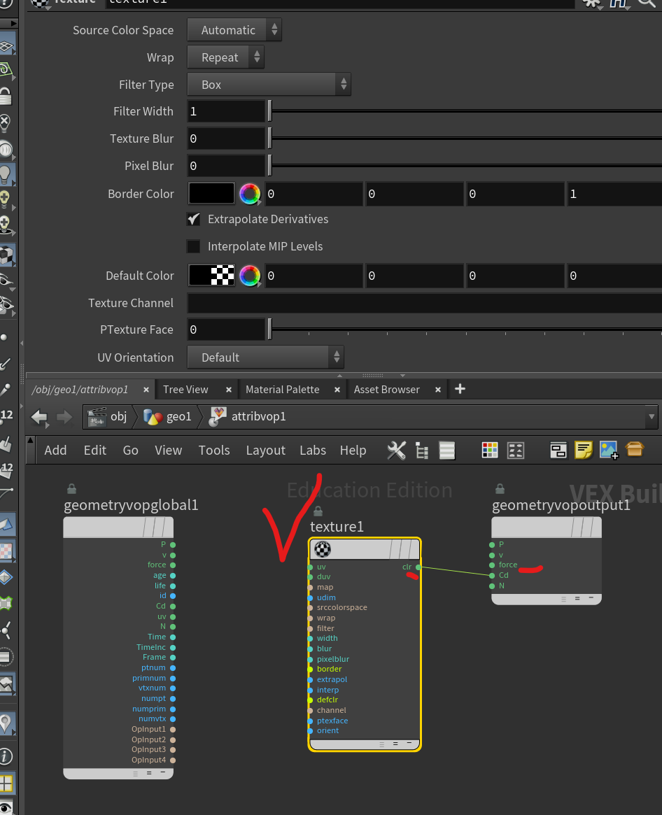
1. grid -uvtexture - attribvop


2. 이미지 데이터가 가진 지형 정보 displacement
texture - vector to float - fit range - displace along normal - geo


'후디니' 카테고리의 다른 글
| houdini _ GEO format_BGEO (0) | 2024.01.03 |
|---|---|
| 후디니 _ AMR(adaptive mesh refinement) (0) | 2024.01.01 |
| Houdini_Algorithmic Tutorial : Recursive Box (0) | 2023.07.24 |
| unity_houdini_part2. houdini asset _c# Script로 파라미터 제어. (0) | 2023.07.12 |
| unity_houdini_part1. houdini Engine Unity package (0) | 2023.07.06 |
- Total
- Today
- Yesterday
- 후디니
- AI
- MCP
- DeepLeaning
- opencv
- MQTT
- krea
- VFXgraph
- 유니티
- Express
- 4dgs
- opticalflow
- houdini
- 라즈베리파이
- Midjourney
- sequelize
- ai film
- Arduino
- RNN
- 4d guassian splatting
- Java
- docker
- Python
- node.js
- three.js
- colab
- Unity
- CNC
- TouchDesigner
- VR
| 일 | 월 | 화 | 수 | 목 | 금 | 토 |
|---|---|---|---|---|---|---|
| 1 | 2 | 3 | 4 | 5 | 6 | 7 |
| 8 | 9 | 10 | 11 | 12 | 13 | 14 |
| 15 | 16 | 17 | 18 | 19 | 20 | 21 |
| 22 | 23 | 24 | 25 | 26 | 27 | 28 |
